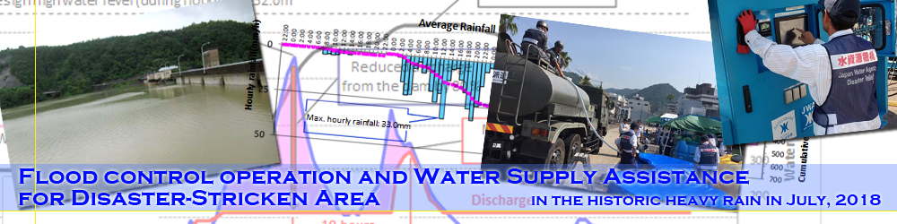
Flood control operation and Water Supply Assistance for Disaster-Stricken Area
in the historic heavy rain in July, 2018
8 August, 2018
Each facility of JWA got ready to take the disaster prevention measures and carried out proper operations in response to the torrential rain in July, 2018.
Flood control operation was conducted at the dams shown below to lower the water level of the downstream river.
- Iwaya Dam (Mase River – Kiso River System)
- Misogawa Dam (Kiso River – Kiso River System)
- Tokuyama Dam (Ibi River – Kiso River System)
- Hiyoshi Dam (Katsura River – Yodo River System)
- Hitokura Dam (Ina River - Yodo River System)
- Sameura Dam (Yoshino River – Yoshino River System)
- Ikeda Dam (Yoshino River – Yoshino River System)
- Teraiuchi Dam (Sada River - Chikugo River System)
- Oyama Dam (Akaishi River –Chikugo River System)
In addition, all the 14 drainage pumping stations were operated to drain of surrounding water at the Lake Biwa development facilities.
Here we posted a preliminary report on the outline of the flood control effect at the following three dams, whose flood control were made by taking advantage of the reservoir capacity up to around the design high water level.
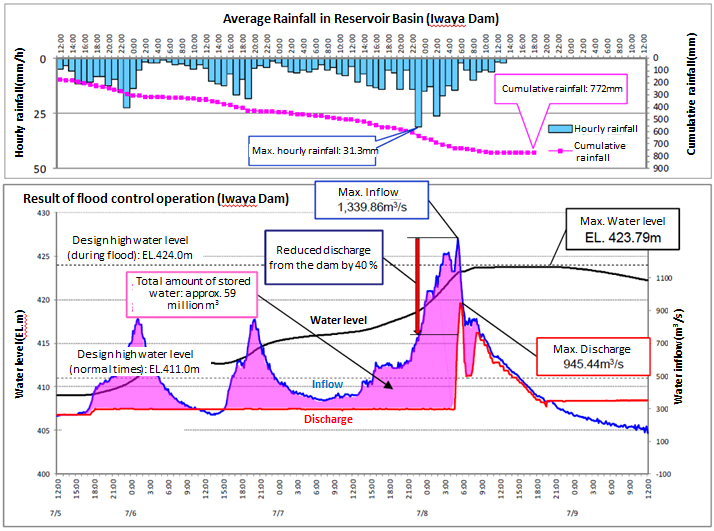
Iwaya Dam (Hida River – Kiso River System in Gifu prefecture)
- The active seasonal rain front caused intermittent heavy rainfall in the reservoir basin. The cumulative rainfall reached 772mm between at 0:00am on 4 July, and at 1:00pm on 8 July. This figure hit a record high since observations began. (The previous one was 532mm made in September 2011).
- Flood control was carried out, making use of the reservoir capacity until the design high water level. The total amount of water stored was approximately 59 million cubic meters. The amount of discharged water to the downstream of the river was reduced by 40 % after the water inflow to the dam had reached its maximum amount.
- The flow rate of the downstream river was decreased as above in order to reduce expected flood damage, and which delayed the time of the peak inflow to secure time for evacuation.
Before starting flood storage - around 9:00am on 4 July
Water level reached near the design high water level– around 3:30pm on 8 July
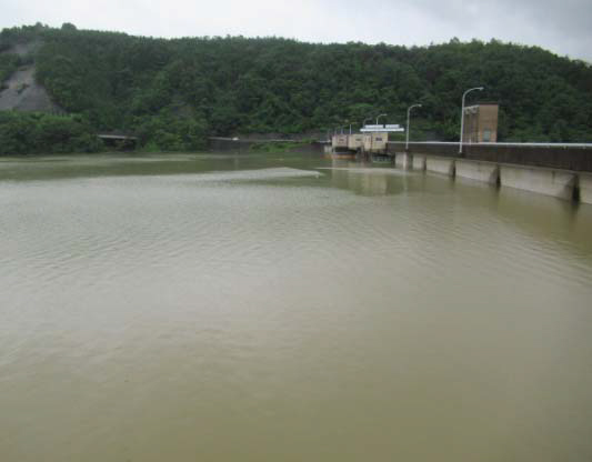
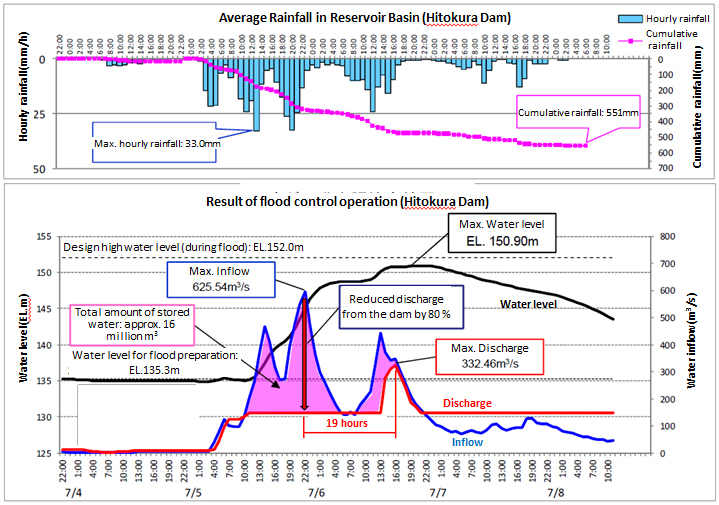
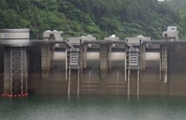
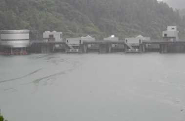
Hitokura Dam (Ina River - Yodo River System in Hyogo prefecture)
- The active seasonal rain front caused intermittent heavy rainfall in the reservoir basin. The cumulative rainfall went up to 551 mm, and the maximum daily rainfall reached up to 330 mm (on 5 July). Both the figures hit a record high since observations began. The daily rainfall in particular, exceeded the design rainfall in the reservoir basin 263 mm.
- Flood control was carried out, making use of the reservoir capacity until the design high water level. The total amount of water, about 16 million cubic meters was stored. The amount of water discharged to the downstream of the river from the dam was reduced by 80 % after the water inflow to the dam had reached its maximum amount.
- The flow rate of the downstream river was decreased as above in order to reduce expected flood damage, and which delayed the time of the peak inflow for 19 hours to secure time for evacuation.
Before starting flood storage - around 10:00am on 2 July
Water level reached near the design high water level - around 5:00pm on 6 July
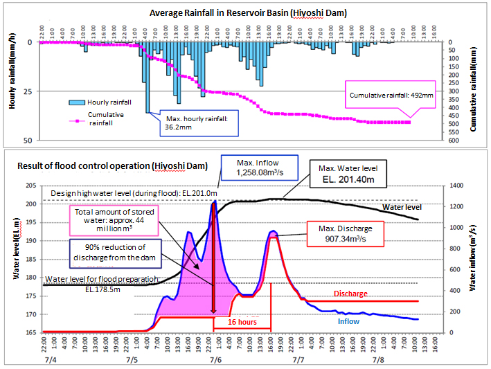
Hiyoshi Dam (Katsura River - Yodogawa Water System in Kyoto prefecture)
- The active seasonal rain front caused intermittent heavy rainfall in the reservoir basin. The cumulative rainfall got to 492 mm, and that maximum for 2 days was came up to 421 mm (on 5 and 6 July). Both the figures hit a record high since observations began. Especially the maximum rainfall for 2 days exceeded the design rainfall in the dam basin 349 mm.
- Flood control was carried out, making use of the reservoir capacityuntil the design high water level. The total amount of water, about 44 million cubic meters was stored. The amount of water discharged to the downstream of the river from the dam was reduced by 40 % after the water inflow to the dam had reached its maximum amount.
- The flow rate of the downstream river was decreased as above in order to reduce expected flood damage, and which delayed the time of the peak inflow for 16 hours to secure time for evacuation.
Right after starting flood storage - around 8:00am on 5 July
Water level reached near the design high water level– around 10:00am on 6 July
Water Supply Assistance for Disaster-Stricken Area
After the disaster caused by the torrential rain, Japan Water Agency dispatched a disaster assistance team and 2 portable seawater desalination apparatus to Mihara City, Hiroshima Prefecture in consultation with Hiroshima Prefecture and provided emergency water supply in order to contribute to recovery and reconstruction of the disaster-stricken area.
Activity Report
- Period: during the period of 15 July to 22 July, 2018 (8 days in total)
- Time: from 9am to 7pm
- Place: Mihara port, Mihara City, Hiroshima Prefecture
- Result of water supply:
- Water for drinking: 35,243.5 litters
- Water for miscellaneous use: 3,040 litters
- 38,283.5 litters in total
- Specification of the apparatus:
- Desalination apparatus No.1
- Treatment capacity: 35m³/day
- Method: Reverse osmosis membrane method
- Desalination apparatus No.2
- Treatment capacity: 50m³/day
- Method: Reverse osmosis membrane method
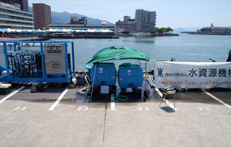
Portable desalination apparatus No.1
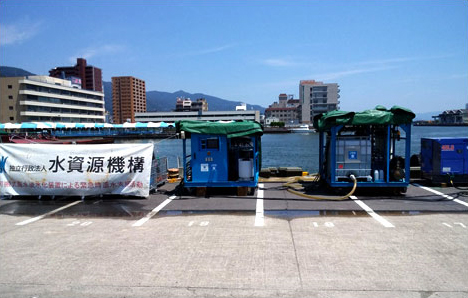
Portable desalination apparatus No.2
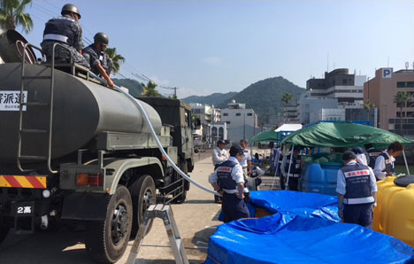
Water supply to the Japan Self-Defense Forces’ water truck
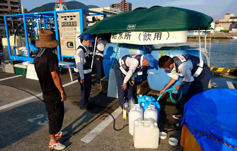
Water supply to neighborhood residents
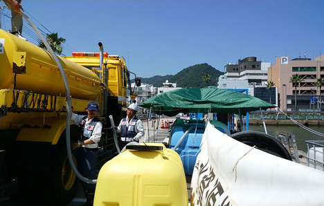
Water supply to MLIT’s sprinkler truck

 Sitemap