
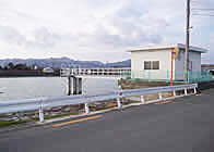
Nabekawa River Lock Gate
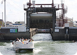
The Nabekawa River Lock Gate is built across the Nabekawa River that connects the Kyu-Yoshinogawa River and the Imagiregawa River.
This is an accessory facility of The Kyu-Yoshinogawa Estuary Barrage to prevent seawater of the Imagiregawa River from running into the Kyu-Yoshinogawa River and to enhance the functions of the Kyu-Yoshinogawa Estuary Barrage.
| Location | Hiroshima, Matsushige-cho, Itano-gun, Tokushima | |
|---|---|---|
| Effective width x length | 6.0 m x 41.0 m | |
| Water gate | Gate | 2 wheel gates 6.0 m in span x 3.5 m in height |
Other management facilities
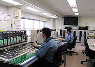
Barrage control facility
This facility collects, calculates, displays and records data needed for barrage control, transmits the data for controlling the water discharging facility, and controls the gates automatically.
Barrage control facility
Rainfall gaging facility (rainfall observatory)
Rainfall gaging equipment is installed in two places: The Kyu-Yoshinogawa Estuary Barrages Management Office and the Higashiyama Rainfall Observatory. The data obtained by the Higashiyama Rainfall Observatory are sent to the Kyu-Yoshinogawa Estuary Barrages Management Office by telemetry.
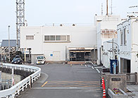
Kyu-Yoshinogawa Estuary Barrages Management Office
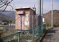
Higashiyama Rainfall Observatory
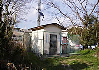
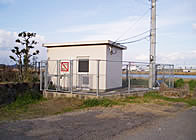
Water level observation facility
A water gauge is installed at the Daiju Sluice Gate Water Level Observatory to measure the upstream-flow and at the Otera Bridge Water Level Observatory to measure the middle-stream flow in addition to the points at the upper and lower stream of the two barrages. The data are sent to the Kyu-Yoshinogawa Estuary Barrages Management Office by telemetry. A water gauge needed to control to let boats through is installed at the lock gates of the both barrages and the Nabekawa River Lock Gate.
Daiju Sluice Gate Water Level Observatory
Otera Bridge Water Level Observatory
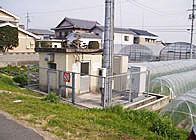
Salt content and water quality observation facility (salt content and water quality observatory)
Salt content is measured at 500m upstream of the Kyu-Yoshinogawa Estuary Barrage on the right side of the river, at 100m upstream of the Imagiregawa Estuary Barrage on the right side of the river and at the separation point of the Nabekawa River from the Kyu-Yoshinogawa River. The data are sent to the management office via wire from the Kyu-Yoshinogawa River and the Imagiregawa River and via wireless telemetry from the separation point of the Nabekawa River. Furthermore, water quality observation is conducted at the observatory for salt content observation at the Kyu-Yoshinogawa Estuary Barrage.
Nabekawa Salt content Observatory
Kyu-Yoshinogawa water quality Observatory
Power supply facility
Both of the barrages receive high-voltage power and the power is supplied to the barrage gate facilities, management office and control station. In case of commercial power outage, a standby generator is installed.
Communication facility
A multiplex radio link is built for remote control and monitoring of both barrages and transmitting data to related organizations.
When a trouble is detected, a hybrid cable installed between the office and the station can be used for data transmission.
![]()
![]()
![]()