Sitemap
Dams, Canals Kanto Area
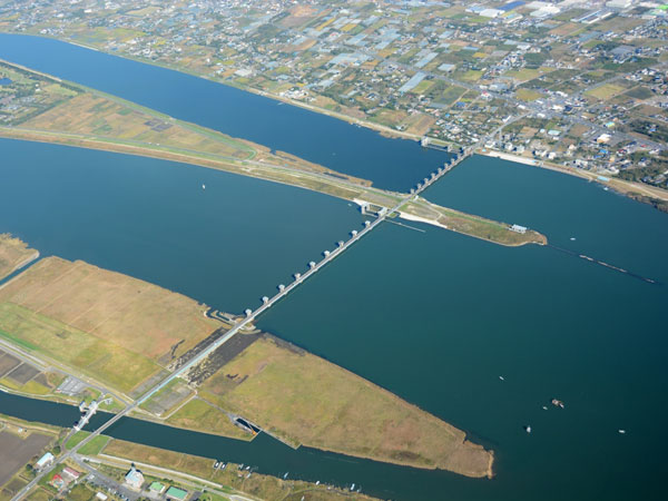
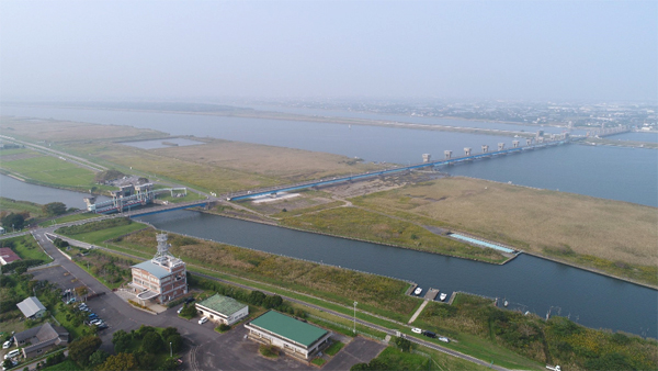
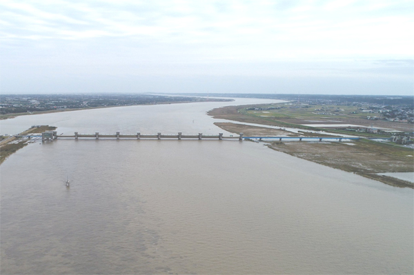
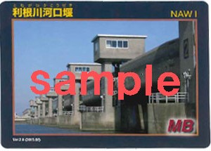
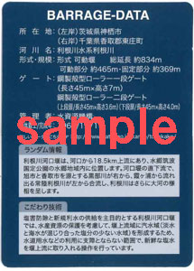
Tonegawa Estuary Barrage


| Purpose | NAWI *See more -> the functions of the dam |
|---|---|
| Location | Kamisu City, Ibaragi Pref. / Tohnosho Town, Katori Gun, Chiba Pref. *See more |
| River | Tone River, Tone River System |
| Type | Movable barrage |
| Gate | Single roller gate Dual roller gate |
| Crest Length(m) | 834(Movablesection:465) |
| Completion | 1971 |
| Details | The purposes of Tone estuary barrage are salinity control and water supply. To conserve the aquatic resources, sea water is conducted upward and brackish water zone is formed at the upstream side of the barrage by operating the gates. The seawater is taken within a range in which it does not affect the water supply. |

Location
- Address
- Tohnosho Town, Katori-Gun, Chiba Pref.,
- Phone No.
- +81-478-86-0477
*Tonegawa Karyu Integrated Operation and Maintenance Office
Access
Highway bus
Bus tarminal:Tokyo station Yaesu exit in front of Mizuho Bank
Bound for Choshi (Both Omigawa route and Sawara route)
Approx.110 min. (Omigawa route) Approx.120 min. (Sawara route)
Bound for Choshi (Both Omigawa route and Sawara route)
Approx.110 min. (Omigawa route) Approx.120 min. (Sawara route)
Train
JR Soubu Line from Tokyo sta. to Chiba sta. and Narita Line from Chiba sta. to Shimousa Tachibana sta.
Approx.180 min. from Tokyo sta. (local train)
Approx.180 min. from Tokyo sta. (local train)
Car
Approx.40 min. from Sawara-Katori IC of Higashi-Kanto Expressway
Dam Card
Tourist Spots
- Katori City (Sawara Area)
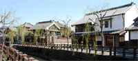 Known as small EDO (Capital City of Japan in Feudal Edo period), Sawara Area attracts visitors with its cozy streets with old-fashioned houses. In the central city area, there is the former house of Tadataka Inou. He is well known as the person who made the first map of Japan with a modern technique. He spent 3,736 days making measurements and travelled 34,913 km, walking through the costal lines and finally created the huge map of Japan in 1821.
Photo by "Travel to Katori" HP
See more ->Travel to Katori- Choshi City
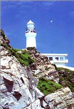 Situated at far eastern end of Kanto Plain facing the Pacific Ocean, this city attracts many fish cuisine lovers. As both the Kuril Current and the Black Current meet ashore, the city boasts of large amount of fish catch, consisting of wide range of fish types. There are many fresh fish restaurants and a famous light house named Inubosaki Light House situated here.
Photo by "Choshi City Tourist Association" HP
See more ->Choshi City Tourist Association (Only Japanese)- Katori (Shinto) Shrine
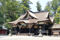 Katori (Shinto) Shrine, No. 1 shrine of Shimousa Province of Chiba Prefecture, provides you with tranquil atmosphere which makes you feel calm and relaxed.
Photo by "Katori (Shinto) Shrine" HP
See more ->Katori (Shinto) Shrine (Only Japanese)
Events
- Sasagawa Sumo Festival (held at the time of Autumn Festival of Suwa Shrine) [Last Sat. of July]
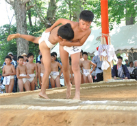 Sasagawa Sumo Festival has a long history, dating back to Edo Period when a local story named "Tenpo Suikoden" about the long territorial battles between the two major Yakuza Groups was really taking place. On the day of the event, various sumo matches such as group matches, tournament matches, and major ranking class matches are held among child sumo players and some representative players from Japanese Self-Defence Forces, stationing near-by. On this day, a parade of some floats and portable shrines supported by local people are also made and the festival lasts until around 10:00 pm.
See more ->Tohnosho Town Tourist Association (Only Japanese)