Sitemap
Dams, Canals Shikoku Area
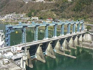
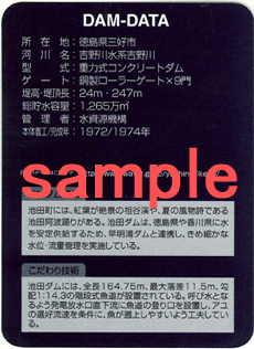
Ikeda Dam


| Purpose | FNAWIP *See more -> the functions of the dam |
|---|---|
| Location | Ikeda City, Tokushima Pref. *See more |
| River | Yoshino River, Yoshino River System |
| Type | Concrete gravity dam |
| Gate | Roller gate:9 |
| Dam Height(m) | 24 |
| Crest Length(m) | 247 |
| Total Storage (1,000m³) |
12,650 |
| Completion | 1974 |
| Details | Ikeda Dam has a stepped fishway whose total length is 164.75m, maximum drop is 11.5m and slope angle of 1:14.3. The entrance of the fishway is located at an outlet of hydraulic power station to guide fishes to the fishway. The flowrate of the fishway is set for easiest run-ups of sweet fishes and other fishes as well. |
Location
- Address
- Miyoshi City, Tokushima Pref.
- Phone No.
- +81-883-72-2050
*Ikeda Integrated Operation and Maintenance Office
Access
Train
Approx.5 min. by car or Approx.30 min. by walk from JR Dosan Line and Tokushima Line Awa-Ikeda sta.
Car
Approx.5 min. from Tokushima Expressway Ikawa-Ikeda IC
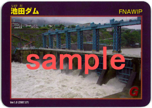
Dam Card
Tourist Spots
- Iya Valley
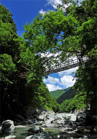 Iya region is located far deeper western part of Tokushima Prefecture. This region used to be one of the regions far remote and hard to access in the mountain. Some improvement has been made in recent years, but this area is still called the Iya Valley region because of the hard accessibility. Because of this situation, the original natural beauty, including some historic vine bridges and the remote local village life are still maintained and this is why it has become the tourist destination among remote retreat seekers.
Photo by "´Oboke and Iya Tourist Navi´ Miyoshi City" HP
See more ->"Oboke and Iya Tourist Navi" Miyoshi City
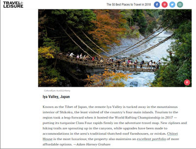 December 05, 2017
 Iya Valley is the only place in Japan to have ever been elected by the travel magazine TRAVEL+LEISURE for "The 50 Best Places to Travel in 2018".
See more -> Travel+Leisure
Events
Coming soon